 |
Complex 10 |
 |
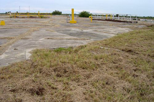
We are standing at the western edge of Complex 10, facing roughly
southeast. In the center of the photo, you can see what looks like curbing that
extends for a short distance into the grass, then abruptly stops. If we were standing
in this same spot in the late 1950's we'd likely be standing in a drainage cut perhaps
ten feet lower than the surface of the launch pad. Be sure to see the historical photo
to see this and the mobile weather cover that used to be at Complex 10.
|
|
Photo courtesy of Steve Sanders
Mission Flight Control Officer, CCAFS
|
',441,291))