|
Complex 10: Mobile weather cover |
 |
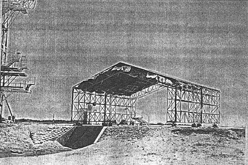
It is likely 1958 or 1959, and we are standing southwestern of Complex 10, facing roughly
northeast. As you can see, there is a very large drainage cut extending in a westerly direction from
the launch area. Also notable is the mobile weather cover that was used to protect vehicles and
equipment from inclement weather. At left if the Complex 10 Mobile Service Tower. In the distance
between the MST and weather cover, we can see the Cape lighthouse.
|
|
U.S. Air Force/National Archives photo; provided by Pierre Trichet.
|
',441,291))