|
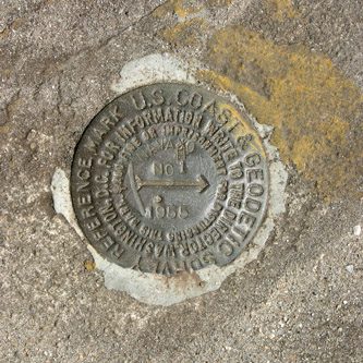
Geodetic survey marker |
 |
|
|
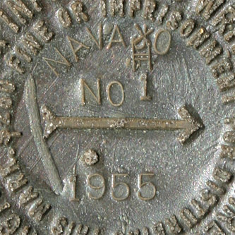
Geodetic survey marker (note correction) |
|
|
This geodetic survey marker (specifically, it's a "Triangulation Station
Disk", with ID AK2464) was emplaced in 1955 and lies south of the Complex 9 launch structure.
The text of the marker reads as follows:
U.S. COAST & GEODETIC SURVEY REFERENCE MARK
FOR INFORMATION, WRITE TO THE DIRECTOR, WASHINGTON, D.C.
$250 FINE OR IMPRISONMENT FOR DISTURBING THIS MARK.
|
The arrow in the center points toward the launch structure. Note the correction: "NAVAHO" was originally misspelled as "NAVAJO".
|
|
Photos courtesy of Steve Sanders
Mission Flight Control Officer, CCAFS
|
',441,291))